Sitting here watching Netflix documentary on MH370 and it got me thinking. It’s my understanding that the majority of international flights, especially over the ocean, are non radar and use reporting points. I’m curious how center sectors are set up in regards to transferring comms to an international facility. Do the lateral confines of airspace run concurrent or is there “no man’s land” between facilities. I would assume centers with oceanic sectors have direct comms with these international facilities but I’ve never talked with anyone who worked it. I’m interested to hear your guys experience and knowledge with how this works.
You are using an out of date browser. It may not display this or other websites correctly.
You should upgrade or use an alternative browser.
You should upgrade or use an alternative browser.
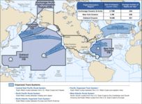
Oceanic Procedures
- Thread starter kilo echo
- Start date
- Messages
- 234
- Facility
- FFZ Falcon Tower
I can only speak for ZOA: Its non-radar but it's not direct voice communication with the planes. CPDLC or relaying through a third-party facility that has HF radios available. The system is called ATOP. ZOA has control of sectors that nearly cover the entire Pacific Ocean.
And yes, there are direct lines to the other facilities to coordinate.
And yes, there are direct lines to the other facilities to coordinate.
Interesting. So is there a definite way to find out where aircraft are at any time or do you just expect them at a certain time to come back in to radar coverage and roll with that?I can only speak for ZOA: Its non-radar but it's not direct voice communication with the planes. CPDLC or relaying through a third-party facility that has HF radios available. The system is called ATOP. ZOA has control of sectors that nearly cover the entire Pacific Ocean.
And yes, there are direct lines to the other facilities to coordinate.
32andBelow
Legendary Member
- Messages
- 10,684
ATOP mainly used automated reporting from the airplanes that they send back via CPDLC. So it’s not radar but it’s very accurate. The plane will send back its late longs speed altitude etc and ATOP will then display its current position.
All the ocean is divided up I think Oakland center basically goes all the way down to border with like New Zealand or some shit.
All the ocean is divided up I think Oakland center basically goes all the way down to border with like New Zealand or some shit.
Attachments
That makes sense. That’s a lot of damn airspace that’s nuts.ATOP mainly used automated reporting from the airplanes that they send back via CPDLC. So it’s not radar but it’s very accurate. The plane will send back its late longs speed altitude etc and ATOP will then display its current position.
All the ocean is divided up I think Oakland center basically goes all the way down to border with like New Zealand or some shit.
- Messages
- 234
- Facility
- FFZ Falcon Tower
There is no radar any meaningful distance from the coast, but ATOP has a visual representation on a screen that, I assume, uses ADS-B and other data to show positions and flight levels. But I'm a dirty know-nothing AG who hasn't worked traffic yet, just monitored.Interesting. So is there a definite way to find out where aircraft are at any time or do you just expect them at a certain time to come back in to radar coverage and roll with that?
Also 32andbelow is right, we talk to facilities half a world away. Largest controlled square mileage of any one facility in the world.
Damn that is wild how that works but it makes sense. I wonder if the advancement of ADS-B and all the nexgen technology if we’ll ever see GPS real time tracking instead of radar coverage being used. That would solve the non radar areas over water I’d imagineThere is no radar any meaningful distance from the coast, but ATOP has a visual representation on a screen that, I assume, uses ADS-B and other data to show positions and flight levels. But I'm a dirty know-nothing AG who hasn't worked traffic yet, just monitored.
Also 32andbelow is right, we talk to facilities half a world away. Largest controlled square mileage of any one facility in the world.
32andBelow
Legendary Member
- Messages
- 10,684
Canada uses sat based ADSB. That’s the obvious next step which should give global radar coverageDamn that is wild how that works but it makes sense. I wonder if the advancement of ADS-B and all the nexgen technology if we’ll ever see GPS real time tracking instead of radar coverage being used. That would solve the non radar areas over water I’d imagine
- Messages
- 187
- Facility
- ZSU San Juan CERAP
San Juan controller here. We coordinate our traffic with foreign facilities as non-radar traffic, even though we have radar coverage to our boundary, and the next facility (with the exception of New York oceanic) has radar coverage on their side. We terminate radar services when we switch them, and the next facility calls them radar once they are talking to them. The only foreign facility we have radar procedures with is MDSD/MDPC. Santo Domingo center and punta cana approach. We call them for Radar handoffs and we have ADE with them so they get automated flight data.
That makes sense with y’all being close to each other. How far off the coast is your guys radar coverage?San Juan controller here. We coordinate our traffic with foreign facilities as non-radar traffic, even though we have radar coverage to our boundary, and the next facility (with the exception of New York oceanic) has radar coverage on their side. We terminate radar services when we switch them, and the next facility calls them radar once they are talking to them. The only foreign facility we have radar procedures with is MDSD/MDPC. Santo Domingo center and punta cana approach. We call them for Radar handoffs and we have ADE with them so they get automated flight data.
- Messages
- 187
- Facility
- ZSU San Juan CERAP
We get somewhere between 200-250 miles, depending on where in our airspace. Our long range radar is out right now so we can usually see the high guys at our boundary (in the flight levels) but the lower guys, ATRs/E120s/C208s tend to drop offThat makes sense with y’all being close to each other. How far off the coast is your guys radar coverage?
- Messages
- 1,563
- Facility
- JNU Juneau Tower
Same as zoa at zny, the oceanic is what makes their traffic count so huge but the domestic people will never admit it
32andBelow
Legendary Member
- Messages
- 10,684
Oceanic just monitors after the radar people set it up for them thoSame as zoa at zny, the oceanic is what makes their traffic count so huge but the domestic people will never admit it
There’s an oceanic add-on in appendix A. It’s a joke but hey ZNYs gotta be a 12 somehow…Oceanic just monitors after the radar people set it up for them tho
Similar threads
- Solved
- Replies
- 16
- Views
- 2K